Optionally generate centroids for selected features
Use pointOnSurface function for QGIS 2.4 and above
Processing script created from the plugin
Use the plugin manager or unzip the downloaded realcentroids.zip into your plugins directory, e.g. ~/.qgis2/python/plugins/.
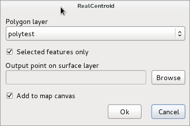
Enable the plugin in the Plugins/Manage and Install Plugins ... dialog. Open the polygon layer you want to create centroids. Start the plugin clicking on the icon in the plugins toolbar or select it from the plugins menu. The following dialog appears
In
the Polygon layer list you can select one from the loaded
polygon layers. If the active layer is a polygon layer then it will
be selected in the list. The Selected features only is enabled
if there are selected features in the selected layer. Select a new
shapefile clicking on the Browse button, . If you select an
existing shapefile, you get a warning weather to overwrite that
shape. If you check Add to map canvas the point shape with the
internal points is added to the current project. The attributes of
the polygons are also copied to the target point shape file. If
Polygon layer or Output point on surface layer is
empty, a warning will be displayed.
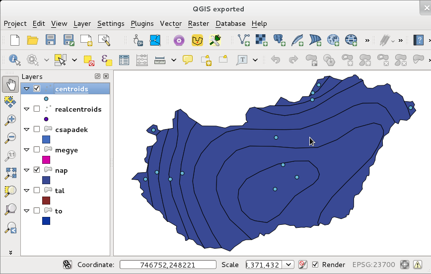
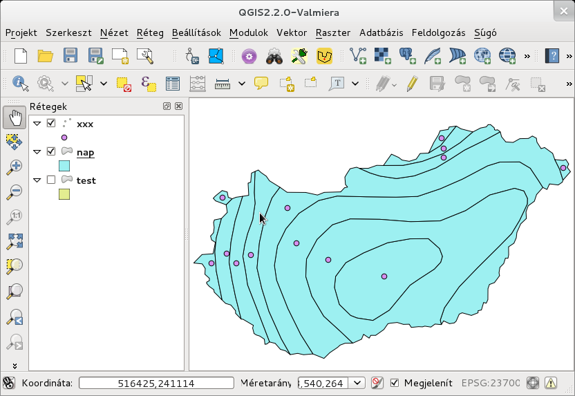
Why do we need such plugin? There is a Polygon centroids option in the Vector/Geometry Tools menu. This will create centroids at the weight point of the vertexes of the polygon. So it can be outside the polygon in a concave or multipart case. Realcentroid will place the point always inside the polygon. See figures below to compare the results of the two methods. From QGIS 2.4 the GEOS pointOnSurface is available from Python/C++ API too, but the Polygon centroids tool doesn't use it. My plugin uses pointOnSurface function for QGIS version 2.4 and newer.
Centroids
(weight points) created by Vector/Geometry Tools/Polygon centroids
Points
on surface generated by RealCentroids plugin
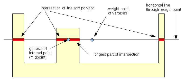
For each polygons the weight point is generated first. If the weight point is outside, the intersection of the horizontal line through the weight point and the polygon is generated. The midpoint of the longest line segment from the intersection result will be used. See the figure below.
For multipart polygons the algorithm is used for the largest part.
Internal
point generation
After QGIS 2.4 the pointOnSurface (GEOS) function is used.
Thanks to Seal Phone, Jukka Rahkonen, ozak and pxp44 (github) giving advices, bug reports to improve the plugin.